Sandra Guinand is a post-doc researcher at the University of Vienna and an associate researcher at EIREST Paris 1–Sorbonne. In her latest project, Citizen Science plays an important role to conduct findings for her research. In her blog article she describes her experience and project surrounding Vienna’s Donau City.
I have been involved in the field of urban geography and urban studies for several years and followed an approach which looks at how people shape space but also how, in turn, space influences people’s behaviour (the so-called Lefebvrian approach). My current research focuses on the qualitative production of space. This implies looking at the actors at the origin of the place being produced (governance and negotiation processes) (Guinand, 2017), the way it is implemented and managed over time, but also the reception and sense-making undertaken by users – espace vécu – (Lefebvre, 2000). This is the latter dimension that I am exploring together with Yvonne Franz, Ana Montalvo and Mark Scherner within Donau City Vienna. Donau City as an urban site is particularly worth investigating, as it is a new built area that has been experiencing tremendous changes over the past decades and which is still under major redevelopments.
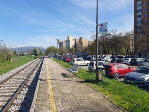
Donau City
Donau City
Donau City is located on the Northern-Eastern side of the historical centre of Vienna. It used to host a landfill waste site and informal settlements before the city held a referendum (1991) on the holding together with Budapest of the 1995 Universal Exhibition. Following the refusal of the population, the space was directly opened for a multifunctional redevelopment project. At the time, this meant, for city authorities, to reduce the office building pressure in the city centre while strategically establishing the capital as a financial centre for Eastern Europe (especially following the opening of markets and economies in Eastern Europe). In order to manage the whole project, public authorities put together The Vienna Danube Region Development Corporation (WED). This corporation was at first composed of Government authorities (City and Land) along with Austrian banks and insurance companies before becoming the sole property of Bank of Austria. Today, this structure is entirely in the hands of the UniCredit financial group, which over the years, has sold a number of properties on the site.
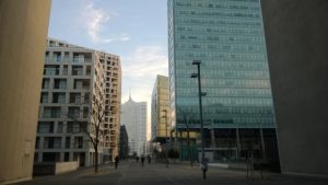
The urban composition of this site is characteristic of the functionalist period of the 1970s with a dominant mineral landscape, separated levels for pedestrian, motorized flows and technical infrastructures. The redevelopment of the area has been witnessing various masterplans and the redevelopment project is still under way with the DC tower, the highest in Austria, as the latest major construction. First investigations stressed that the fragmentation over time of the WED had created a confusion on the management and responsibility of spaces previously in its hands (WED) which in turn had destructured the readability (Lynch, 1960) and spatial organization of this built environment.
Understanding the constitutive elements of the built environment
In the scope of this explorative project, together with my colleagues I intend to test photo-walk and photo-elicitation interviews (Aitken & Wingate 1993; Mogensen 2012; Lombard 2013) with residents and users of Donau City as a mean to collect data on the perception and intangible dimensions (emotions, experiences, memories) of this socio-cultural landscape. This will help us get a better understanding of the residents’ and users’ different spatial perceptions and receptions of this area (emic perspective), how they make sense of everyday practiced and the lived space (Harrison, 2000; Bigando, 2013; Schoepfer, 2014). This should help us characterize and depict the salient tangible and intangible features of this area. This should help establish a better understanding of Donau City’s environment, and of new built environments more generally.
However, this perspective can only be reached through a bottom up approach, meaning the users and residents involvement in the research.
Using photography
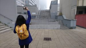
Photography as a qualitative research method stems from anthropology and ethnography (Bateson & Meads, 1942; Collier & Collier, 1986; Schwartz, 1989). It is considered useful in order to study socio-cultural continuity and changes, as for example, in the case of Donau City. The method is particularly interesting in the sense that it makes use of the polysemic properties of photographs (Barthes, 1964; Sekula, 2013). As Edward T. Hall mentions, photographs carry little “new” information but instead they reveal meanings, intangible values that are already in the viewer (1971). This photograph communicational property (Rose, 2016) will be helpful as a mean to establish a better understanding of Donau City’s environment. This method will then offer a precise understanding of perception mechanisms and space understanding from an emic perspective.
A citizen science project
This project is part of a Citizen Science project granted by the Faculty of Astronomy, Earth and Science and Geography at the University of Vienna. This implies that citizen take actively part in the research project. We thus intend to work with 10 and 15 persons. A first meeting explaining the scope of the research, the method and how to proceed regarding the next steps of our collaboration will take place. The discussion based on the persons’ everyday life and practices of the areas aims at preparing the photo-walk. After this first interview, the participant will take a walk combining photography on his/her own. He or she will walk with a camera, in order to take between 6 and 10 pictures, which he/she feels best illustrate and characterize the area. The participant will be free to choose the itinerary both in terms of distances and time. The second interview will begin with sharing the experience of the photo-walk. The participant will then explain the reasons for choosing the particular itinerary, the used procedure for taking the pictures. We will then conduct the photo-elicitation interview. The selected photographs backed with participants’ interviews content analysis will compose the data corpus. The outcomes of the project will be published in a journal and disseminated through the Faculty’s website. Results will of course be communicated to the participants.
The outcomes of the project will be presented in December during an event organized by the Faculty of Astronomy, Earth and Science and Geography at the University of Vienna. Participants will be invited to this exciting event.